2.8 Mixed Use Regional Connectors

High-volume streets with wide right of way that serve a mix of land uses.
Description
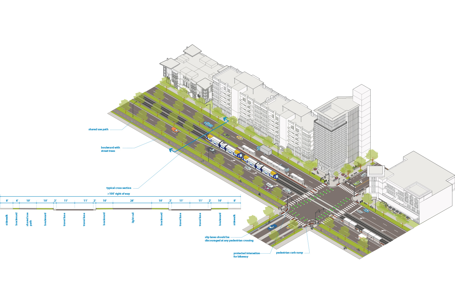
Mixed Use Regional Connectors are high-volume streets (typically 10,000+ average daily traffic) with wide right of way that serve a mix of land uses. These streets often must balance providing local access and serving regional transportation connections. Mixed use Regional Connectors often include high-capacity transit and high walking demand
Examples include Hiawatha Avenue, Olson Memorial Highway, and New Brighton Boulevard
Typical Characteristics
|
Miles |
~27 miles |
|
Right of Way Width |
Typically 130’ or wider |
|
Effective Right of Way |
Typically 130’ or wider |
|
Functional Class |
Principal Arterial or Minor Arterial |
|
Jurisdiction |
|
|
Route |
State Trunk Highway, County State Aid Highway, or Municipal State Aid |
|
Modal Network |
|
|
Snow Emergency Route |
Yes |
|
Historic Street |
No |
Typical Design and Operations
See Street Design Guidance chapter for more information
|
Sidewalk |
See sidewalks guidance for more details. |
|
Boulevard and Furnishing |
See boulevards and furnishings guidance for more details. |
|
Bikeway |
For streets on the All Ages and Abilities bikeway network, trails should be used. |
|
Transit |
|
|
Freight |
All are on the Truck Route Network. |
|
Roadway |
|
|
Design speed |
30 - 40 mph See design speed guidance for more detail. |
|
Design vehicle |
Most commonly SU-30 or WB-40 depending on intersecting street and context. See design and control vehicles guidance for more details. |
|
Control vehicle |
Most commonly WB-62, but can also be Aerial Fire Truck Mid Mount 100 depending on intersecting street and context. See design and control vehicles guidance for more details. |
|
Motor Vehicle Property Access |
See driveways guidance for more details. |
|
Intersection Traffic Control |
Signal control or stop control |
|
Intersection details |
Slip lanes should be discouraged when interacting with any pedestrian crossing. |
Typical Cross Sections
Figure 2.8.1:
Mixed Use Regional Connector street with light rail transit and trail