Limited use streets that provide property access and primary locations for freight loading and waste collection.
Description
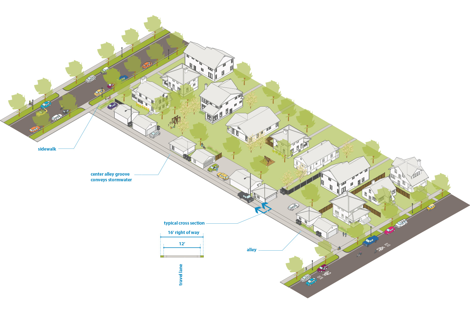
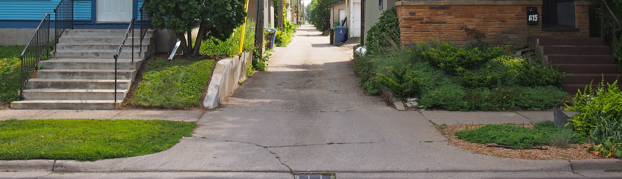
Alleys are limited use streets that provide property access and serve as primary locations for freight loading and solid waste, recycling, and organics collection. Alleys are located throughout the city, most commonly in Urban Neighborhood areas. The street is designed for low speeds of 10 mph or less, where people walking, biking, and driving share space. Alleys are not intended for through traffic and design elements should discourage traveling more than one block.
Typical Characteristics
|
Miles |
~426 miles |
|
Right of Way Width |
12’-14’ on most residential alleys |
|
Effective Right of Way |
Typically the same as right of way width |
|
Functional Class |
N/A |
|
Jurisdiction |
City of Minneapolis |
|
Route |
N/A |
|
Modal Network |
None |
|
Snow Emergency Route |
No |
|
Historic Street |
No |
Typical Design and Operations
See Street Design Guidance chapter for more information
|
Sidewalk |
No dedicated sidewalk. Pedestrians use the shared roadway space. |
|
Boulevard and Furnishing |
Landscaping is not typically included in alleys, but green stormwater infrastructure may be included as appropriate to treat and/or reduce stormwater runoff. |
|
Bikeway |
No dedicated bikeway. People bicycling use the shared space. |
|
Transit |
Transit service not provided. |
|
Freight |
Not included on the Truck Route Network. Provide access for solid waste, recycling, and organics collection and accommodate frequent loading up to 30 minutes in both residential and commercial alleys, which is allowed per City of Minneapolis ordinance. |
|
Roadway |
|
|
Design speed |
10 mph See design speed guidance for more detail. |
|
Design vehicle |
N/A. Typically use 5’ curb-return radius. See curb-return radii guidance for more details. |
|
Control vehicle |
N/A |
|
Motor Vehicle Property Access |
Serves as a primary loading access for most properties in the city. |
|
Intersection Traffic Control |
Yield control |
|
Intersection details |
None |
Typical Cross Section
Figure 2.12.1:
Residential alley (12’ wide)